
Post Category : Glossary
Glacial Flutes

By Kurtis Blaikie-Birkigt on August 2, 2017
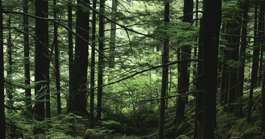
Ryan is doing layout work to protect wetlands and streams during aerial herbicide application and he got this great shot of glacial fluting northeast of Calling Lake.
These parallel ridges were formed when the Laurentide ice sheet coming southwest from the Canadian Shield hit bedrock uplands at the east end of the Pelican Mountains. The base of the glacier formed a saw-tooth pattern that scoured these ridges and troughs for several kilometers.

Related Posts

By Fallon Hardie
February 12, 2025
Culturally Modified Trees of the Interior, British Columbia
A Foreword For the Archaeologists who’ve found themselves interested in the niches of Ecology and Landscape-Use-Dynamics, we tend to recognize the landscape as a dynamic whole; a manuscript of activities, knowledge, and ideologies that human societies have crafted and applied to the environments in which they live. However, Professional Consulting Archaeologists in Cultural Resource Management
Keep Reading
By Maegan Huber
January 31, 2025
Alberta’s Boreal Sand Hills
Alberta’s Boreal Sand Hills Some people may be surprised to learn that Alberta is home to a series of large sand hill complexes made up of large forested dune features. Typically, when we think of sand dunes we tend to picture hot and dry regions with minimal vegetation, often situated near oceans. However, Alberta’s boreal
Keep Reading
By Braedy Chapman
July 2, 2023
Top sites of 2022, BC edition
Field operations in British columbia 2022 marked Ember Archaeology’s first year of significant field operations in British Columbia. Our BC crews conducted a number of sizable wildfire-related projects for the BC Ministry of Forests over the course of the season, ultimately surveying hundreds of kilometers of constructed fireguards and fuel reduction developments. These were nearly
Keep Reading