Post Category : Local Archaeology Special Finds
Checkout our Slave Lake Roadshow April 9, 2016
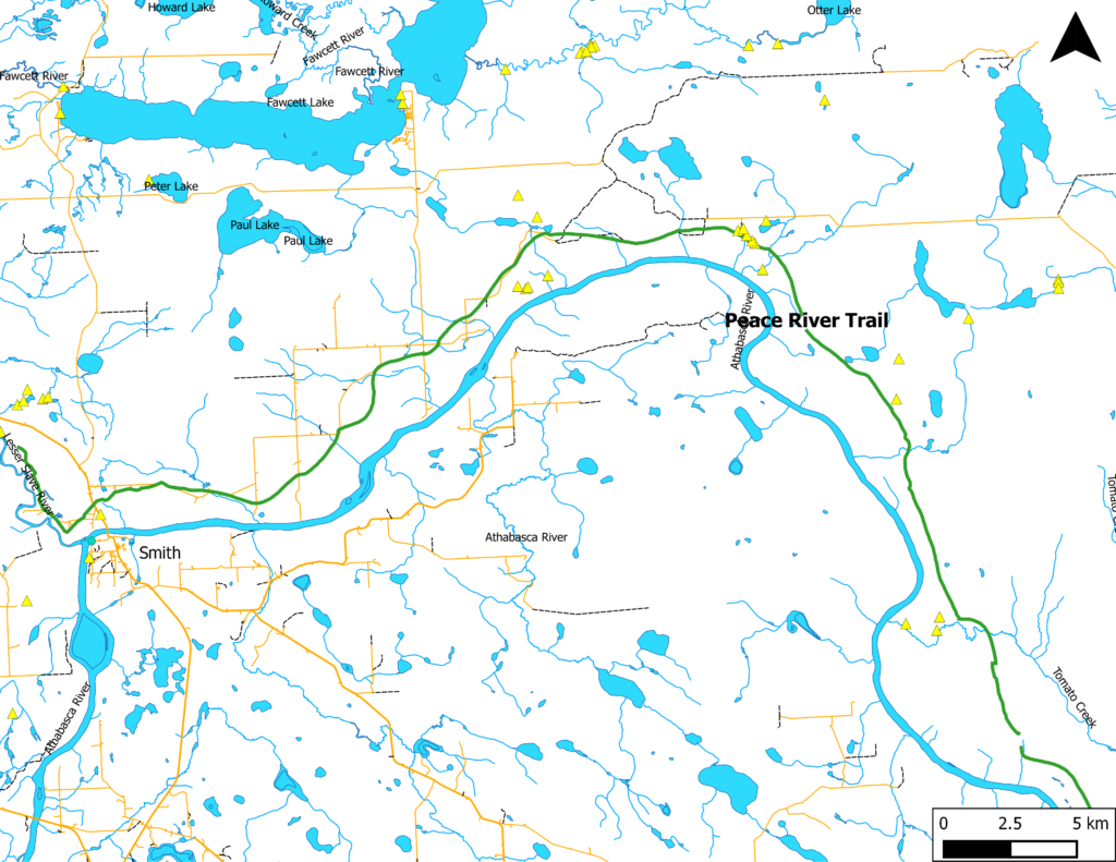
This Saturday, April 9, 2016, Tree Time archaeologists will be giving a presentation on some of our survey results in forestry developments along the historic Peace River Trail, which is located on the north shore of the Athabasca River between Smith and Sawdy, AB. This trail is now the modern Peace River Wilderness Trail, a part of the Trans Canada Trail mission, and follows approximately the same route as the historic trail. Originally, the historic trails in the area were created by Aboriginal people, using the Athabasca River as a major corridor, either by foot or canoe, and later by horse. As Europeans began to traverse the same areas, whether it be for trading, homesteading, or exploring, they would follow the same trails, rather than create new ones. Over time, the Peace River Trail became wider and well-traveled, with small reroutes as people forged new trails around areas that became impassable.
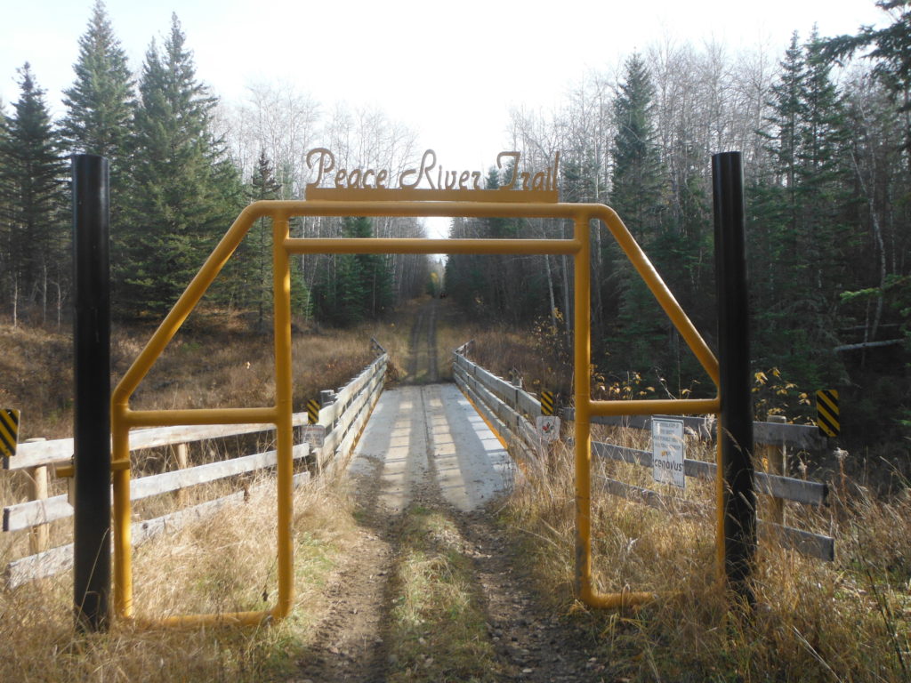
Archaeological survey along the trail, beginning in 2006, has identified 19 sites with one or more prehistoric, historic, and contemporary components. These sites indicate the trail has been in use continuously over time. However, giving dates to these sites and determining how long this area, and possibly the trail, has been used for is very difficult because we do not often find items that can be placed during a specific time frame. Tree Time has been fortunate that during our 2013 and 2014 field seasons, we found one site that can be confidently dated to the Middle Precontact Period (4500-4100 BP), and one site to the historic period, with contemporary use.
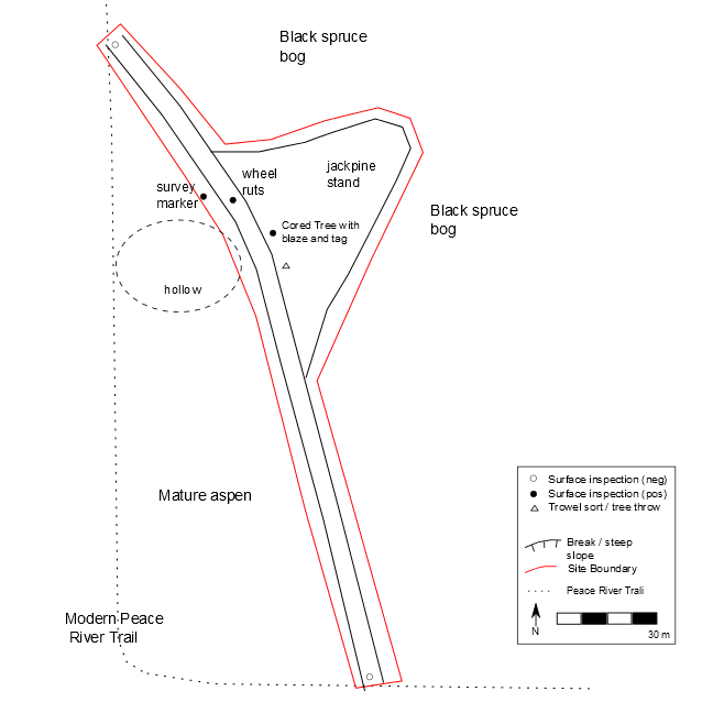
At the historic site, GgPj-1 we found an older segment of the historic trail that has not been heavily used for some time. We even found evidence of wagon ruts! Directly along the path we found a tree blaze (a tree that was marked by removal of some of its bark). By coring the tree, we were able to determine that the tree blaze was made around 1958 AD. Only a few steps off the trail, we found a land survey pin with the typical four holes placed evenly around the pin. Starting in 1910, the Alberta Township System was implemented, following a method very similar to the Dominion Land Survey system. This site, although not exactly along the present-day designation of the township system, is only approximately 200 m off.
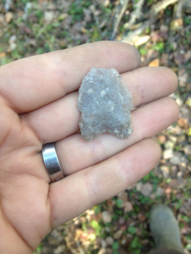
At the second site, GhPj-12, we found a nearly-complete quartzite Oxbow dart point. The Oxbow cultural phase dates between 4500 and 4100 BP. The site is located 700 m southwest of the modern Peace River Trail, right along the Athabasca River upper valley margin. The landform itself is very flat with excellent edges along the sides, and a little erosion at the point. Finding the Oxbow was clearly a moment of luck because only two artifacts were recovered from GhPj-12! Out of the 17 shovel tests we placed around the site, only one shovel test contained artifacts.
To hear more about how these two sites, along with other sites in the area help us piece together the history of the Athabasca River and the Peace River Trail, come check out our Roadshow at the Boreal Centre in Slave Lake, AB, April 9th (1-5 pm) We will have a Stones and Bones session, where you can show us your finds. Don’t forget to try your hand at Atlatl throwing, one of the hunting methods used during the Middle Preconact Period, including the Oxbow culture!

