
Post Category : Field Life Local Archaeology
Wind Storm in the Slave Lake Region Aids in the Discovery of Giant Archaeological Site.

By Brian Leslie on May 9, 2019
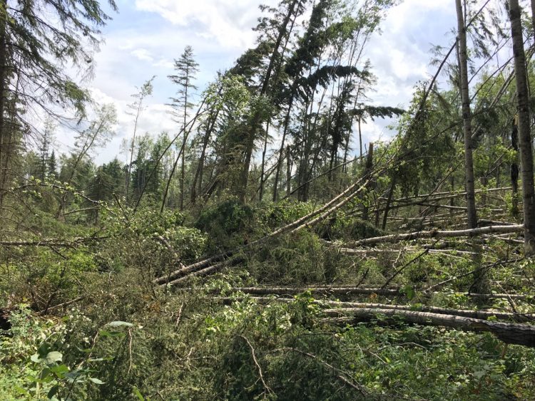
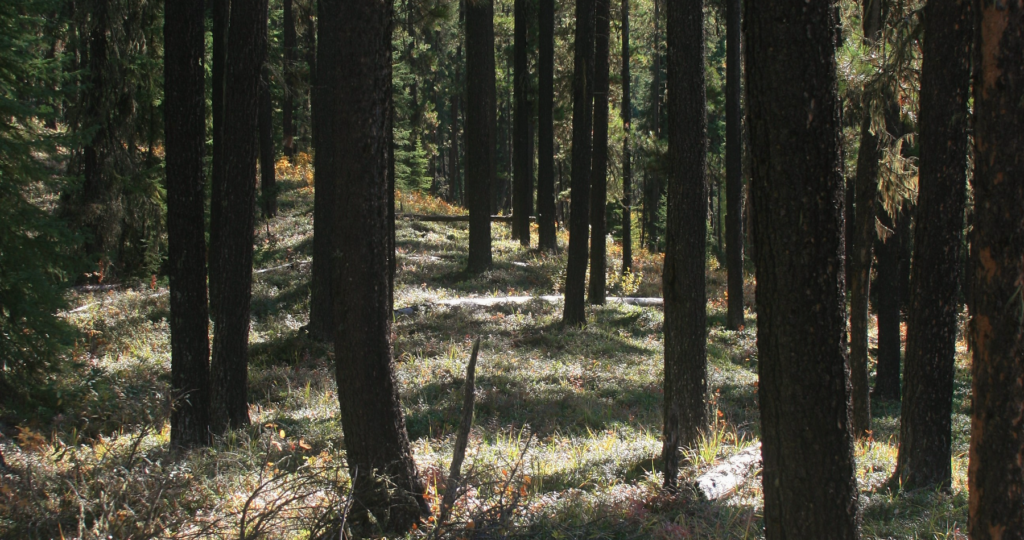
In July of 2017, some forests in the vicinity of Slave Lake experienced catastrophic blow down when a fast moving storm swept through central Alberta. The large storm system caused high winds and localized flooding in many areas, including Slave Lake and Edmonton. It also dropped golf ball sized hail on Drayton Valley and spawned a tornado near Breton. Whole sections of forest were devastated by winds in excess of 100 km/hr. It was speculated that the severe wind and heavy rainfall may have resulted in a reduced number of juvenile birds, from both ground and tree nesting species, in the Slave Lake region.
The archaeologists at Tree Time Services Inc. conduct Historic Resources Impact Assessments (HRIA) for many of the forest product companies that operate in the Slave Lake region. Prior to the commencement of any harvest activities, these companies must ensure that their operations are not going to adversely impact any archaeological, historic or cultural sites.
A few of the cutblocks that Vanderwell Contractors (1971) Ltd. had scheduled for harvest in 2017, were completely flattened by the storm. Although archaeological survey is usually conducted prior to harvest, the heavy blow down caused by the storm made it extremely hazardous to work in these areas. Pre-impact survey allow forest companies to avoid the historic resources identified by archaeologists and ensure that they are not disturbed by harvest activities. However, the chance of the archaeologists being injured by falling trees and ‘widow makers’ was much too high. The archaeologists had to wait till the timber was salvaged. Even though many of the trees were broken, Vanderwell Contractors was still obligated to complete the HRIA. In some rare circumstances such as this, or salvaging timber from forest fires, archaeologists may have to conduct their survey post-impact, or after the harvest is complete.
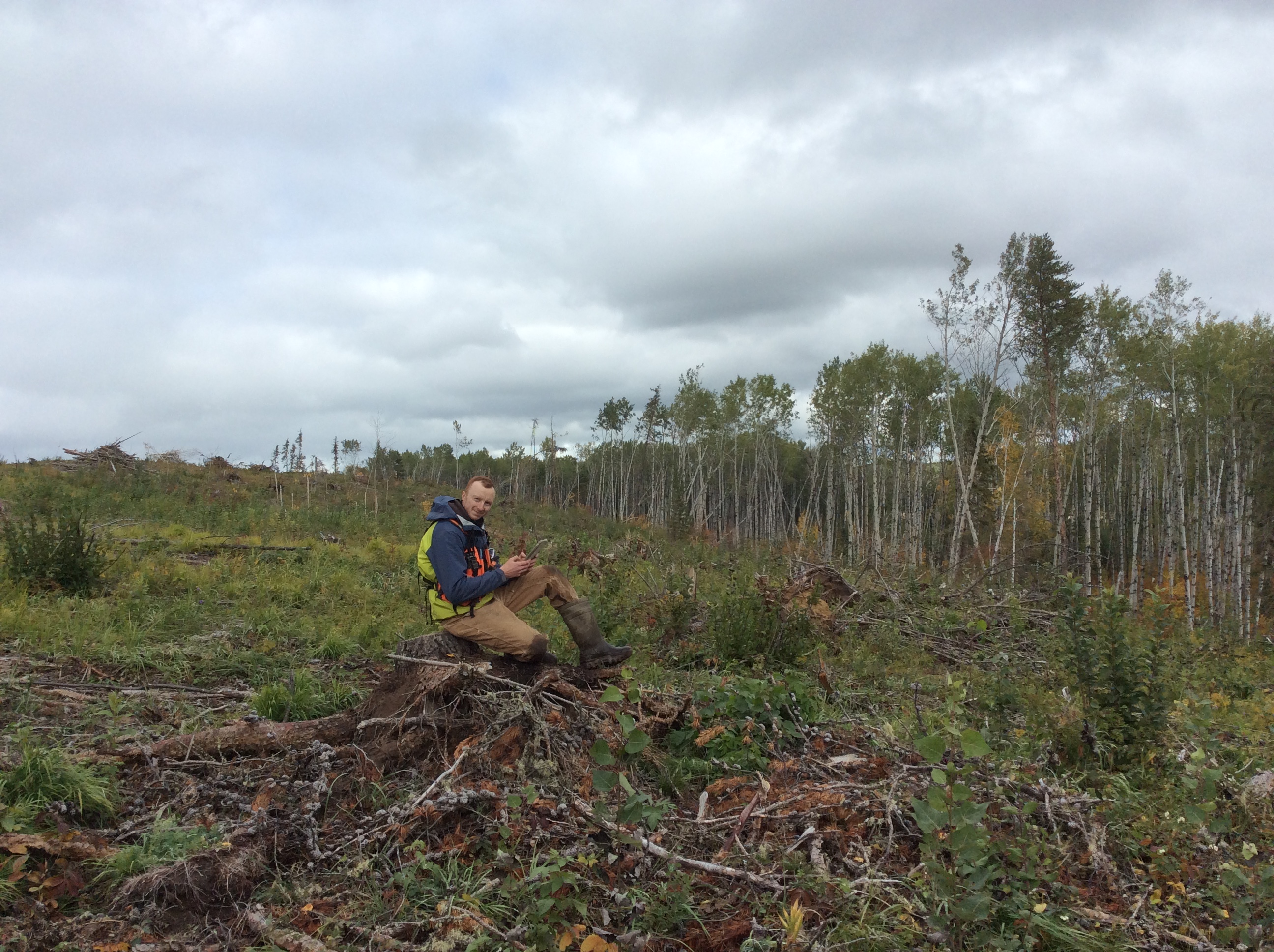
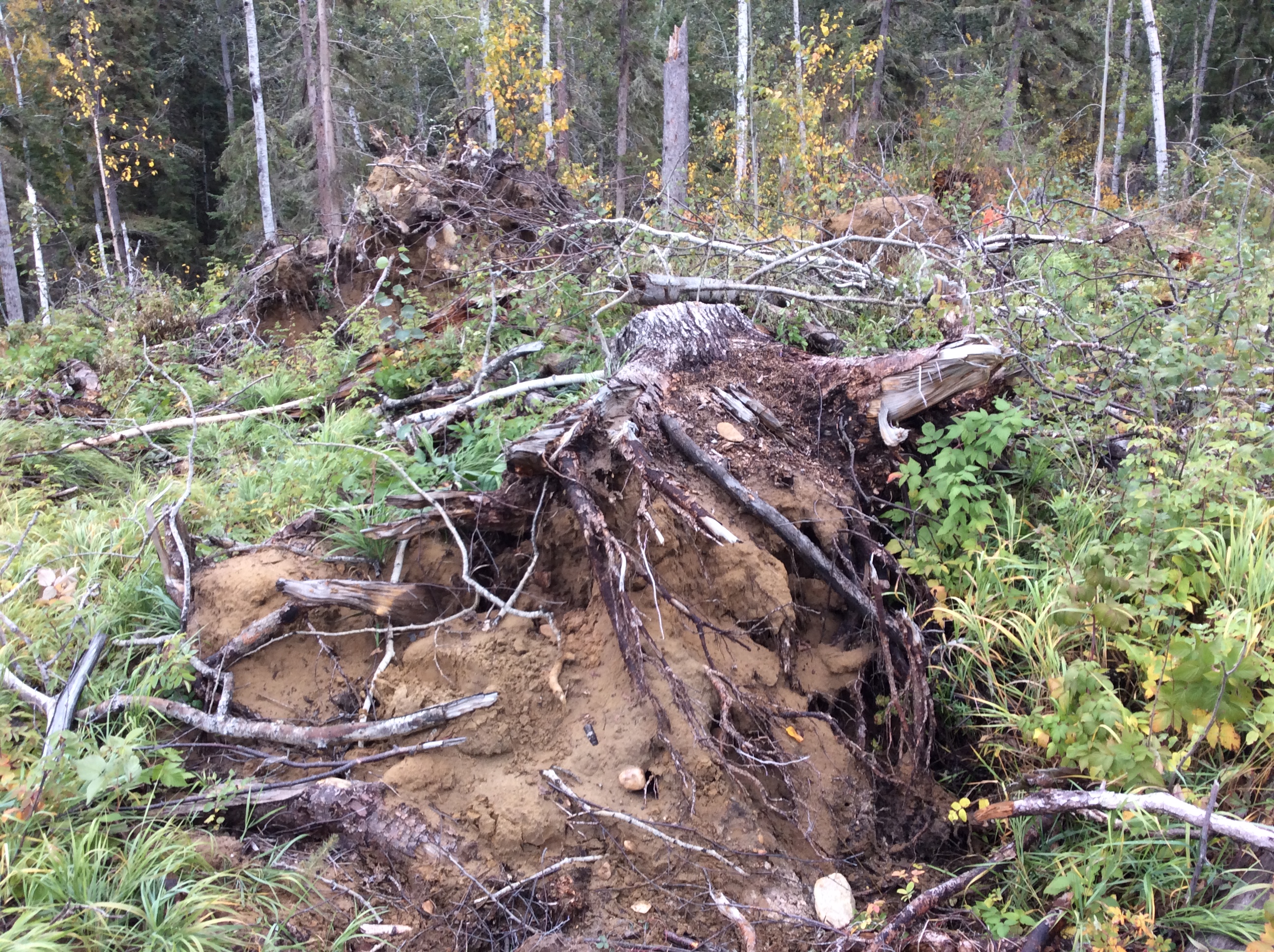
The timber was salvaged during the winter by Vanderwell Contractors, and Tree Time’s archaeologists returned in the summer of 2018 to conduct their search for historic resources. The timber salvage had slightly impacted the area, but it was apparent that many of the trees had been uprooted by the wind storm. Usually cutblocks are full of stumps, which are still rooted in the ground, but these cutblocks were filled with stump piles. Instead of cutting down the trees, the harvesters were simply picking them up and cutting off the ends. To access the salvaged timber, Vanderwell Contractors had to build a small temporary road. The tree throws created by the blow down, as well as harvest operations, led to a substantial amount of exposed sediment, which allowed archaeologists to quickly identify a very large archaeological site: GgPm-7.
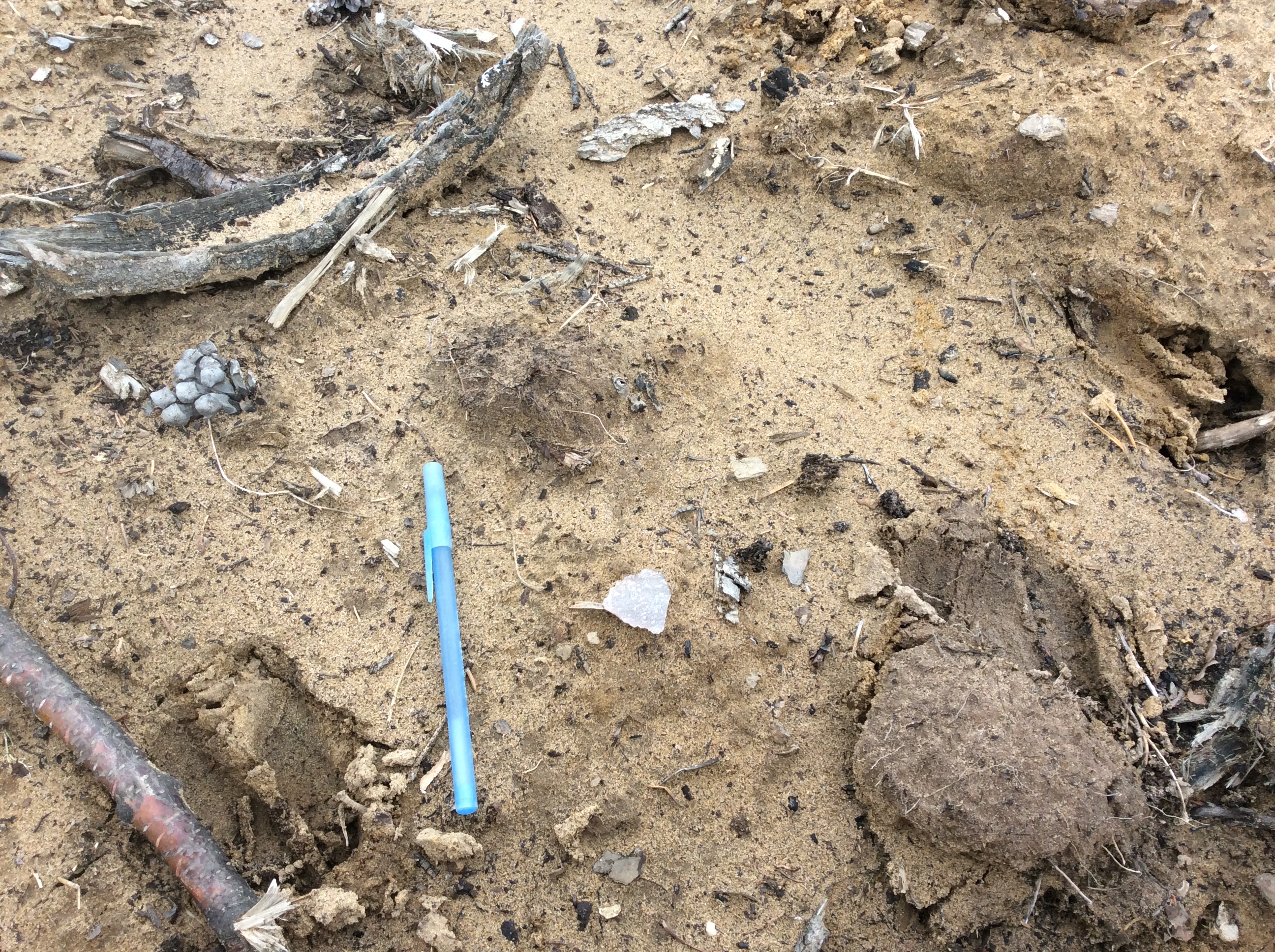
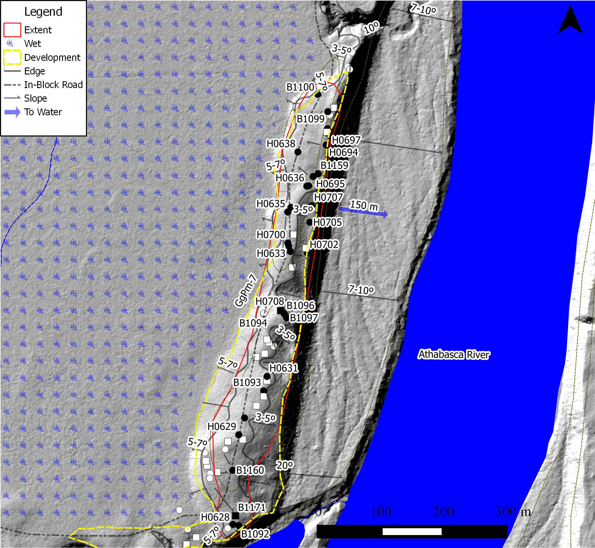
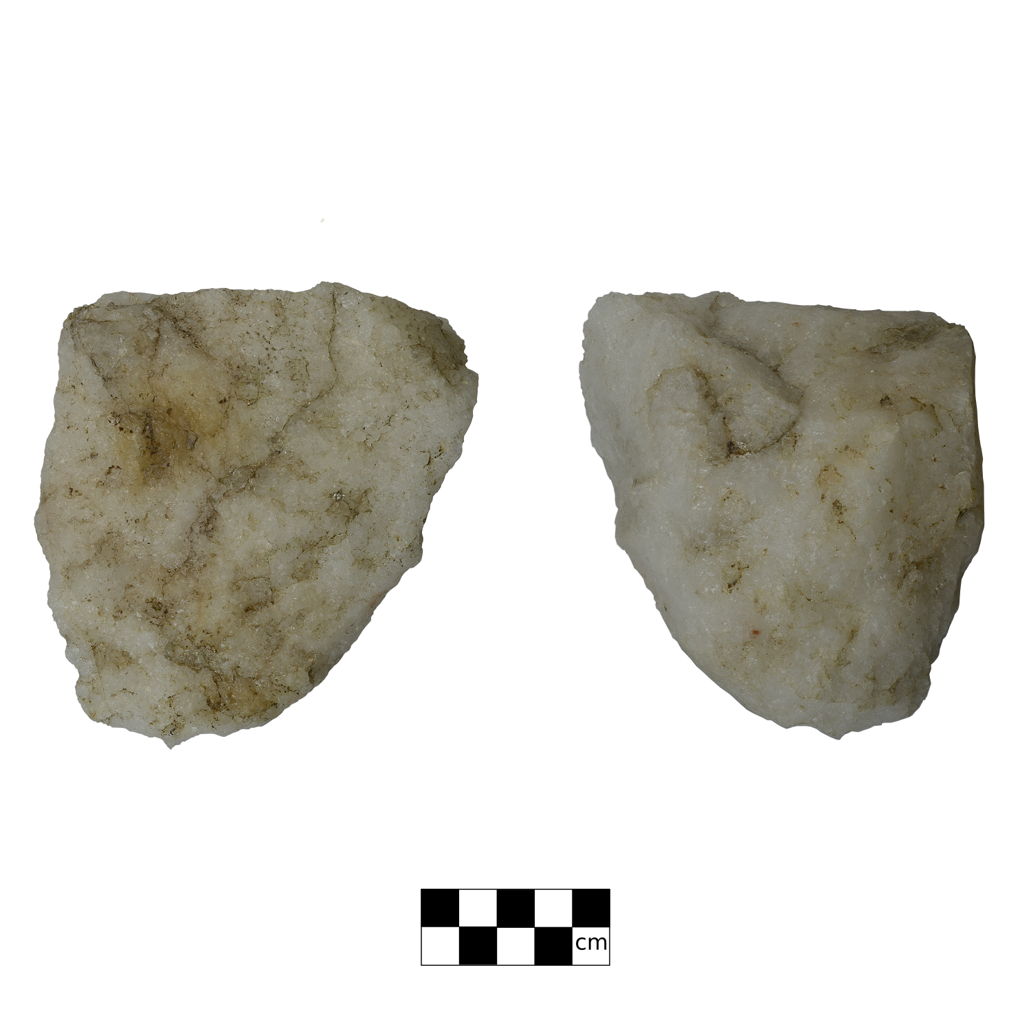
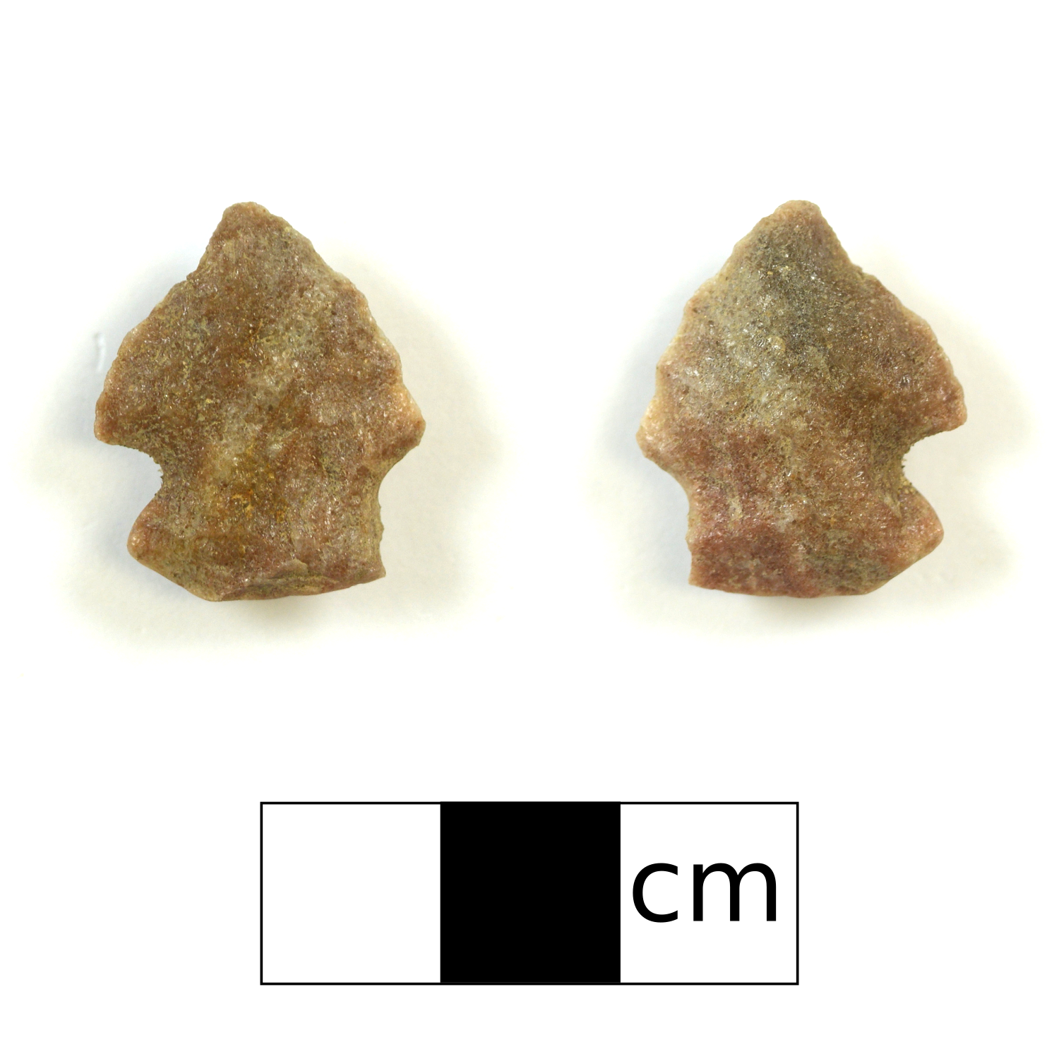
GgPm-7 is a large pre-historic campsite that occupies a long north to south trending sand ridge next to the Athabasca River. The archaeologists found the site while looking for artifacts in the surface exposures created by tree throws on the south end of the ridge. They found four stone flakes (debitage) in the second tree throw they inspected. As they worked their way down the ridge, they continuously examined the surface exposures as they went. They did not stop finding artifacts until they reached the north end of the ridge. The archaeologists then used shovel tests to investigate areas along the ridge that did not have many surface exposures, or where no artifacts were found during the initial sweep. When the delineation was complete, GgPm-7 measured approximately 800 meters in length and 128 artifacts had been collected.
This site is designated as a prehistoric camp based on the variety of artifacts found. A campsite is a somewhat encompassing term given to archaeological sites that display evidence of a variety of different activities including a hearth or other evidence of fire. Stone flakes, or debitage, are found at almost a pre-contact archaeological sites and provide evidence that tool production, or re-sharpening. The presence of stone cores suggest that early stage stone tool production, or the production of flakes that could be turned into tools at a later time, had occurred.
The discovery and delineation of GgPm-7 highlights an important issue facing CRM archaeologists working in the forestry sector. Although pre-impact survey allows for sites to be identified before they have been disturbed, the work at GgPm-7 clearly indicates that not only are sites much easier to find post-impact, but they are also much easier to delineate. Of the 27 surface inspections that were conducted by the archaeologists, artifacts were observed in 22. In contrast, of the 22 shovel tests that were dug, artifacts were only recovered from 3. There is little doubt that a pre-impact survey of this landform would have identified an archaeological site. However, there is a very good chance that shovel tests alone would have failed to display the extensive size of the site. Although surface exposures can compromise site integrity, they allow archaeologists to quickly assess an area without conducting labour intensive shovel tests.
Related Posts

By Fallon Hardie

March 20, 2026
Fight or Flight: Lessons Learned From a Cougar Encounter, Part II
Continuing the Conversation In February 2026, Fallon Hardie (Jr. Field Director, Ember) met with Kim Titchener (President and Founder, Bear Safety & More Inc) to discuss the 2024 encounter. The interview covered the increasing challenges of cougar encounters in Alberta, predator / prey behaviour dynamics, the criticality of expert training based on current data, and
Keep Reading
By Fallon Hardie
May 19, 2025
Fight or Flight: Lessons Learned From a Cougar Encounter
Fight or Flight: Lessons Learned From a Cougar Encounter While completing Historic Resource Impact Assessments (HRIA) in the Lower Eastern Foothills of Alberta during the Summer of 2023 (maybe mid-July or August), I experienced something allegedly unlikely: a cougar encounter. Like any professional working in the wilderness, I have completed numerous Bear Safety and Wildlife
Keep Reading
By Maegan Huber
January 31, 2025
Alberta’s Boreal Sand Hills
Alberta’s Boreal Sand Hills Some people may be surprised to learn that Alberta is home to a series of large sand hill complexes made up of large forested dune features. Typically, when we think of sand dunes we tend to picture hot and dry regions with minimal vegetation, often situated near oceans. However, Alberta’s boreal
Keep Reading