
Post Category : Glossary Local Archaeology
Alberta’s Boreal Sand Hills

By Maegan Huber on January 31, 2025
Alberta’s Boreal Sand Hills
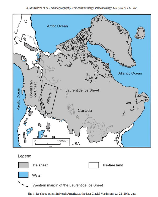
Some people may be surprised to learn that Alberta is home to a series of large sand hill complexes made up of large forested dune features. Typically, when we think of sand dunes we tend to picture hot and dry regions with minimal vegetation, often situated near oceans. However, Alberta’s boreal sand hills are land locked and are often fully vegetated. Additionally, they are a result of extensive deglaciation activity that took place between 15.6 and 13.5 Cal ka BP.
Dune Formation and Stabilization
From a geological perspective, sand dunes are accumulations of fine-grained sediments deposited by wind and gravity. The accumulations, or mounds, are created when windblown (aeolian) sediments encounter a solid object, such as rock or vegetation, which stops the forward motion of the sediments. As a result, the accumulation of sediment enlarges the obstruction, and a dune begins to form (Figure 7; Ghrefat 2011:2). Many variables, such as grain size distribution, wind regime, vegetation, and surface moisture all affect aeolian sand transport (Neuman and Scott, 1998:403-419; Iversen and Rasmussen, 1999: 723-731; Ghrefat 2001:2).
Additionally, vegetation plays a vital role in dune formation, activation, and stabilization. The physical presence of vegetation suppresses the movement of sand by trapping moving particles, and reduces the velocity of the wind above the grounds surface, preventing fine-grained particles from becoming airborne (Muhs and Wolfe 1999:188; Wolfe and Nickling 1993:50-52; 1997:8; Panas 2018:29).
Evidently, vegetation increases the presence of moisture within the dune feature by providing shade. Furthermore, detritus from decaying plant matter increases the organic content of the soils, increasing the water retention capacity (Hudson 1994:193; Panas 2018:29). In addition, the presence of plant roots acts as a deterrent to erosional processes and the subsequent reactivation of dunes. The effectiveness is also observed where surface vegetation is minimal, such areas that have experienced fires or drought (Courtwright 27 2023:17; Thomas and Redsteer 2016:401; Panas 2018:30). Interestingly, some distinctive geomorphic features such as parabolic dunes, require the presence of boreal vegetation to form.
History of Geomorphic Processes in Alberta
Alberta’s boreal sand hills were formed in an ice-proximal tundra setting after deglaciation, as the Laurentide and Cordilleran Ice Sheets began to retreat. Strong winds predominantly blew from the northwest, and they funneled along the ice margins between the retreating ice sheets. As the Laurentide retreated eastward, between 13.5 to 13.0 Cal ka BP, much of central Alberta’s former tundra vegetation was replaced with parkland vegetation in the north, and grassland vegetation in the south (Dyke et al., 2004).
The more the ice sheets retreated, the more vegetation began to develop as a result. As such, this change affected the translocation of fine sediments and effectively created distinctive dune features. Boreal forest vegetation began to cover the aforementioned areas between 13.0 and 9.0 Cal ka BP, leading to the stabilization of the dunes. In many cases, the dunes have remained stable and forest-covered since then, showing little to no reactivation activity. Unlike their counterparts on the prairies, which have been reactivated and reformed throughout the centuries.
Archaeology On The Dunes
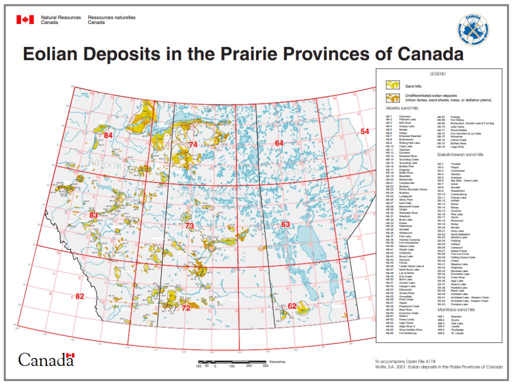
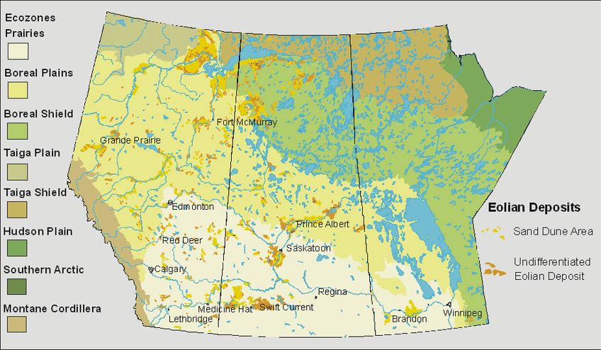
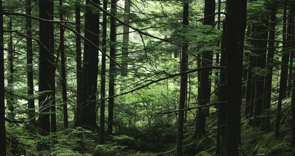
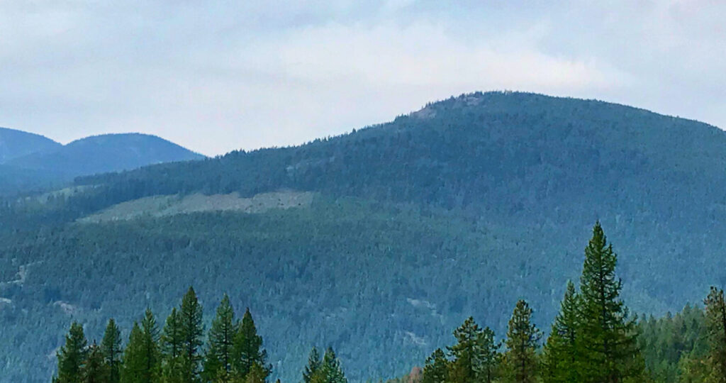
Alberta’s boreal sand hills are extremely interesting in an archaeological sense! Sand hill complexes tend to be ecologically distinct from their surrounding environment. Notably, the dunes are prominent on the landscape, averaging 5-10 m in height (before forest cover) and stretching up to 1km in length. Furthermore, Lodgepole pine forests tend to favor the well-drained and nutrient-deficient sediments that construct the dunes. The margins of sand hill landforms are often well-defined, sloping steeply down to low-lying wetland and Sphagnum muskeg (peatlands) terrain in the inter-dune spaces.
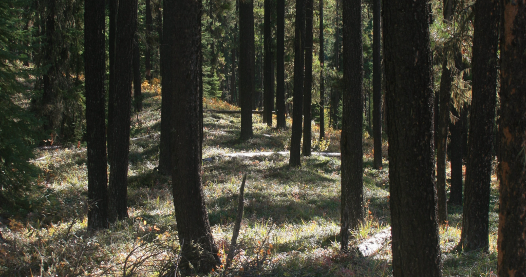
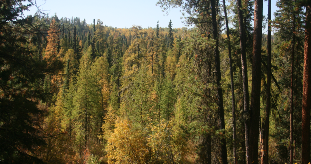
View along the crest of a large boreal sand dune. Maegan Huber, 2022.
Accumulatively, this would have provided access to water, as well as to the unique flora and fauna that thrive in the wetlands. For example, waterfowl, moose, deer, beavers, and other fauna would have been drawn to these areas, and the elevation of the dunes would have provided an ideal vantage point for hunters. Evidently, the aforementioned landform attributes made it possible for people to easily navigate across the wetlands without wading through muskeg and water. In some cases, it is possible to walk for kilometers along the crests, traversing from one dune to the next. Ease of travel would have made these resource-rich areas even more attractive for past people.
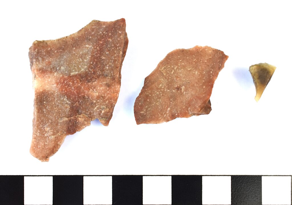
Archaeological investigations have been conducted within many of Alberta’s boreal sand hills, leading to the identification of a vast number of archaeological sites. No comprehensive study of the dunes has been completed. However, it is a general trend that the sand dunes yield significantly higher site returns than the surrounding terrain. As such, it is clear that these features were heavily utilized by past peoples.
Maegan Huber
Permit Archaeologist
Related Posts

By Fallon Hardie
February 12, 2025
Culturally Modified Trees of the Interior, British Columbia
A Foreword For the Archaeologists who’ve found themselves interested in the niches of Ecology and Landscape-Use-Dynamics, we tend to recognize the landscape as a dynamic whole; a manuscript of activities, knowledge, and ideologies that human societies have crafted and applied to the environments in which they live. However, Professional Consulting Archaeologists in Cultural Resource Management
Keep Reading
By Corey Cookson
October 17, 2023
International Archaeology Day
What is it? International Archaeology Day is a celebration of Archaeology and it’s contributions to society! International Archaeology Day annually falls on the third Saturday of October (October 21st), and was first celebrated in 2011. The day was originally designed on a national level to help promote public participation and awareness of the important contributions
Keep Reading
By Alyssa Hamza
August 10, 2023
“The Last Great Battle”
Battle of Belly River, 1870 For International Indigenous Day, there are an unlimited number of topics that we could discuss. This year, since Lethbridge is my home and I’m interested in it’s history, I decided to write about “The Battle of the Belly River”, also called the “The Last Great Indian Battle”. One of the
Keep Reading